

Large Sized Map: Atsumi Peninsula and Environs
更新日:2016年2月1日
Details
Large Sized Map: Atsumi Peninsula and Environs
Maps/Drawings
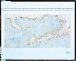
Year: 1804
Scale: 1:36,000
The duplicate copy produced when a set of maps covering the eastern parts of Japan was submitted to the Shogunate government.
■ File Informaiton
W 2659px X H2131px
JPEG Format 2230KB
本文ここまで